
Thank you for supporting this site ❤️
Make a donation
Make a donation
Hisar topographic map
Click on the map to display elevation.
Thank you for supporting this site ❤️
Make a donation
Make a donation
About this map
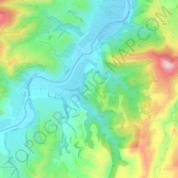
Name: Hisar topographic map, elevation, terrain.
Location: Hisar, Krumovgrad, Kardzhali, Bulgaria (41.51233 25.62748 41.55233 25.66748)
Average elevation: 285 m
Minimum elevation: 176 m
Maximum elevation: 516 m
Thank you for supporting this site ❤️
Make a donation
Make a donation
Other topographic maps
Click on a map to view its topography, its elevation and its terrain.