
Thank you for supporting this site ❤️
Make a donation
Make a donation
Gisakura topographic map
Click on the map to display elevation.
Thank you for supporting this site ❤️
Make a donation
Make a donation
About this map
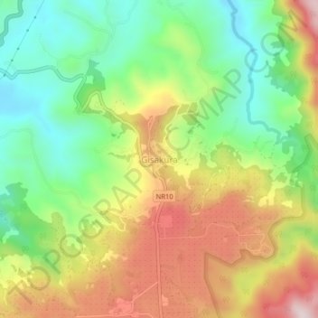
Name: Gisakura topographic map, elevation, terrain.
Location: Gisakura, Bushekeri, Nyamasheke, Western Province, Rwanda (-2.45610 29.07111 -2.41610 29.11111)
Average elevation: 1,772 m
Minimum elevation: 1,539 m
Maximum elevation: 2,078 m
Thank you for supporting this site ❤️
Make a donation
Make a donation