
Thank you for supporting this site ❤️
Make a donation
Make a donation
Lawin topographic map
Click on the map to display elevation.
Thank you for supporting this site ❤️
Make a donation
Make a donation
About this map
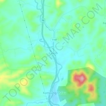
Name: Lawin topographic map, elevation, terrain.
Location: Lawin, Hulu Perak District, Perak, Malaysia (5.27645 101.03804 5.31645 101.07804)
Average elevation: 134 m
Minimum elevation: 89 m
Maximum elevation: 271 m
Thank you for supporting this site ❤️
Make a donation
Make a donation
Other topographic maps
Click on a map to view its topography, its elevation and its terrain.