
Thank you for supporting this site ❤️
Make a donation
Make a donation
Ajegunle topographic map
Click on the map to display elevation.
Thank you for supporting this site ❤️
Make a donation
Make a donation
About this map
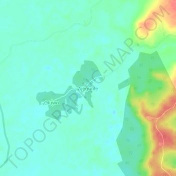
Name: Ajegunle topographic map, elevation, terrain.
Location: Ajegunle, Obafemi Owode, Ogun State, Nigeria (6.94398 3.31226 6.98398 3.35226)
Average elevation: 24 m
Minimum elevation: 6 m
Maximum elevation: 72 m
Thank you for supporting this site ❤️
Make a donation
Make a donation