
Thank you for supporting this site ❤️
Make a donation
Make a donation
Makhu topographic map
Click on the map to display elevation.
Thank you for supporting this site ❤️
Make a donation
Make a donation
Makhu
Makhu has an average elevation of 201 metres (659 feet). This town is located near the edge of Harike Sanctuary. It is 5 km away from the confluence of Satluj and Beas rivers.
Thank you for supporting this site ❤️
Make a donation
Make a donation
About this map
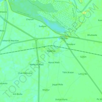
Name: Makhu topographic map, elevation, terrain.
Location: Makhu, Zira Tahsil, Firozpur, Punjab, 142044, India (31.06274 74.95041 31.14274 75.03041)
Average elevation: 210 m
Minimum elevation: 203 m
Maximum elevation: 222 m
Thank you for supporting this site ❤️
Make a donation
Make a donation