
San Vicente Tancuayalab topographic map
Interactive map
Click on the map to display elevation.
About this map
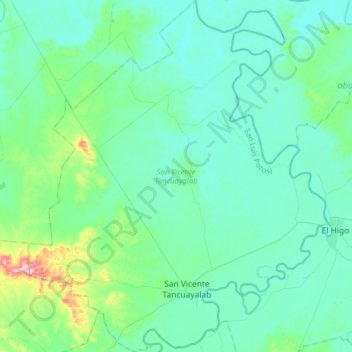
Name: San Vicente Tancuayalab topographic map, elevation, terrain.
Location: San Vicente Tancuayalab, San Luis Potosi, Mexico (21.66538 -98.73066 21.95990 -98.45470)
Average elevation: 43 m
Minimum elevation: 6 m
Maximum elevation: 266 m