
Thank you for supporting this site ❤️
Make a donation
Make a donation
Chondhe Budruk topographic map
Click on the map to display elevation.
Thank you for supporting this site ❤️
Make a donation
Make a donation
About this map
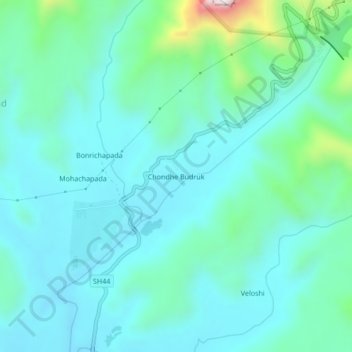
Name: Chondhe Budruk topographic map, elevation, terrain.
Location: Chondhe Budruk, Shahapur Taluka, Thane, Maharashtra, India (19.49302 73.60835 19.53302 73.64835)
Average elevation: 270 m
Minimum elevation: 166 m
Maximum elevation: 761 m
Thank you for supporting this site ❤️
Make a donation
Make a donation