
Koranga River topographic map
Interactive map
Click on the map to display elevation.
About this map
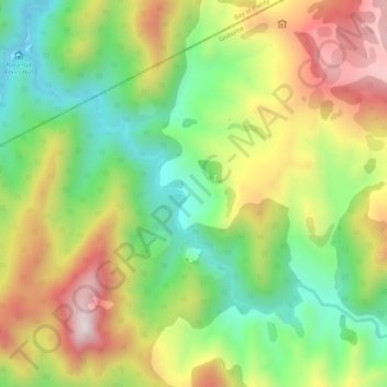
Name: Koranga River topographic map, elevation, terrain.
Average elevation: 582 m
Minimum elevation: 255 m
Maximum elevation: 999 m
Other topographic maps
Click on a map to view its topography, its elevation and its terrain.
Parinui
Nouvelle-Zélande > Bay of Plenty > Ōpōtiki District
Parinui, Ōpōtiki District, Bay of Plenty, 3162, Nouvelle-Zélande
Average elevation: 67 m