
Thank you for supporting this site ❤️
Make a donation
Make a donation
Grand Meix topographic map
Click on the map to display elevation.
Thank you for supporting this site ❤️
Make a donation
Make a donation
About this map
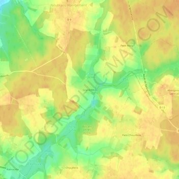
Name: Grand Meix topographic map, elevation, terrain.
Average elevation: 206 m
Minimum elevation: 183 m
Maximum elevation: 217 m
Thank you for supporting this site ❤️
Make a donation
Make a donation
Other topographic maps
Click on a map to view its topography, its elevation and its terrain.
Abergement-Saint-Jean
France > Bourgogne-Franche-Comté > Jura > Neublans-Abergement
Average elevation: 208 m