
Múlaþing topographic map
Interactive map
Click on the map to display elevation.
About this map
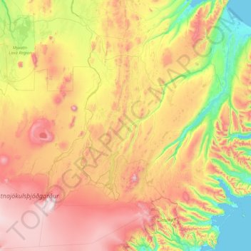
Name: Múlaþing topographic map, elevation, terrain.
Location: Múlaþing, Eastern Region, Iceland (64.46165 -16.71108 65.73035 -13.57633)
Average elevation: 625 m
Minimum elevation: -2 m
Maximum elevation: 1,876 m