
Lidón topographic map
Interactive map
Click on the map to display elevation.
About this map
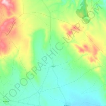
Name: Lidón topographic map, elevation, terrain.
Location: Lidón, Comunidad de Teruel, Teruel, Aragón, España (40.69506 -1.16275 40.76084 -1.04946)
Average elevation: 1,273 m
Minimum elevation: 1,179 m
Maximum elevation: 1,456 m