
Chenet topographic map
Interactive map
Click on the map to display elevation.
About this map
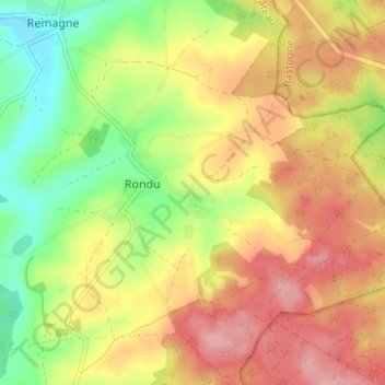
Name: Chenet topographic map, elevation, terrain.
Average elevation: 493 m
Minimum elevation: 429 m
Maximum elevation: 551 m
Other topographic maps
Click on a map to view its topography, its elevation and its terrain.
Nimbermont
Belgique > Luxembourg > Neufchâteau > Rondu > Nimbermont
Nimbermont, Rondu, Remagne, Libramont-Chevigny, Neufchâteau, Luxembourg, Wallonie, Belgique
Average elevation: 482 m