
Thank you for supporting this site ❤️
Make a donation
Make a donation
Inverness topographic map
Click on the map to display elevation.
Thank you for supporting this site ❤️
Make a donation
Make a donation
About this map
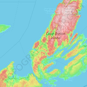
Name: Inverness topographic map, elevation, terrain.
Location: Inverness, Inverness County, Nouvelle-Écosse, Canada (45.46819 -61.91974 46.86819 -60.51974)
Average elevation: 77 m
Minimum elevation: -3 m
Maximum elevation: 531 m
Thank you for supporting this site ❤️
Make a donation
Make a donation