
Rio Alheda topographic map
Interactive map
Click on the map to display elevation.
About this map
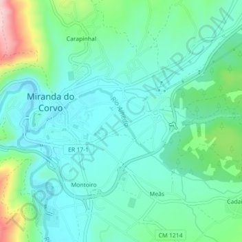
Name: Rio Alheda topographic map, elevation, terrain.
Average elevation: 145 m
Minimum elevation: 95 m
Maximum elevation: 307 m
Other topographic maps
Click on a map to view its topography, its elevation and its terrain.
Rio Corvo (Rio Dueça)
Portugal > Centro > Miranda do Corvo
Rio Corvo (Rio Dueça), Miranda do Corvo, Coimbra, Pinhal Interior Norte, Centro, 3220-154, Portugal
Average elevation: 241 m
Posto de Vigia Chães
Portugal > Centro > Miranda do Corvo > Senhor da Serra
Posto de Vigia Chães, EM 568, Senhor da Serra, Semide, Semide e Rio Vide, Miranda do Corvo, Coimbra, Pinhal Interior Norte, Centro, 3030-853, Portugal
Average elevation: 256 m