
Vegadeo topographic map
Interactive map
Click on the map to display elevation.
About this map
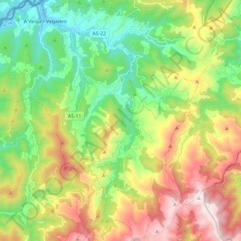
Name: Vegadeo topographic map, elevation, terrain.
Location: Vegadeo, Astúrias, Espanha (43.35704 -7.10635 43.47427 -6.94690)
Average elevation: 453 m
Minimum elevation: -3 m
Maximum elevation: 1,181 m