
Make a donation
Sungai Kechil topographic map
Click on the map to display elevation.
Make a donation
About this map
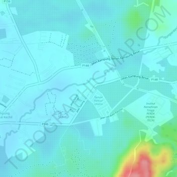
Name: Sungai Kechil topographic map, elevation, terrain.
Average elevation: 18 m
Minimum elevation: 2 m
Maximum elevation: 110 m
Make a donation
Other topographic maps
Click on a map to view its topography, its elevation and its terrain.
Make a donation
George Town
The jurisdiction of George Town covers an area of approximately 306 km2 (118 sq mi), encompassing the entirety of Penang Island and nine surrounding islets. George Town is slightly more than two-fifths the size of Singapore. The 295 km2 (114 sq mi) Penang Island has an uneven terrain with a mountainous…
Average elevation: 53 m
Make a donation
Make a donation
Make a donation
Make a donation
Make a donation
Penang National Park
Malaysia > Penang > George Town
There are two major trails in the Park, leading to Muka Head lighthouse and Pantai Kerachut respectively. The trail branches of at Pasir Pandak Hut. The trail leading to Muka Head lighthouse stops at Teluk Tukun, where it branches off to the canopy walkway, where it then links to Pantai Kerachut or vice versa.…
Average elevation: 86 m
Make a donation
Make a donation
Make a donation
Make a donation
Make a donation
Make a donation
Paya Terubong
Malaysia > Penang > George Town
The subdivision of Paya Terubong covers an area of 32.7 km2 (12.6 sq mi), forming a corridor that stretches from the central valleys of Penang Island to Jerejak Island off the eastern coast. It encompasses a varied topography and includes several neighbourhoods, namely Farlim, Bukit Jambul, Sungai Dua, Batu…
Average elevation: 129 m
Make a donation
Make a donation
Make a donation
Make a donation
Make a donation
Make a donation
Make a donation
Make a donation
Make a donation
George Town
The jurisdiction of George Town covers an area of approximately 306 km2 (118 sq mi), encompassing the entirety of Penang Island and nine surrounding islets. George Town is slightly more than two-fifths the size of Singapore. The 295 km2 (114 sq mi) Penang Island has an uneven terrain with a mountainous…
Average elevation: 52 m
Make a donation
Make a donation
Make a donation
Make a donation