
Thank you for supporting this site ❤️
Make a donation
Make a donation
Pinon Hills topographic map
Click on the map to display elevation.
Thank you for supporting this site ❤️
Make a donation
Make a donation
About this map
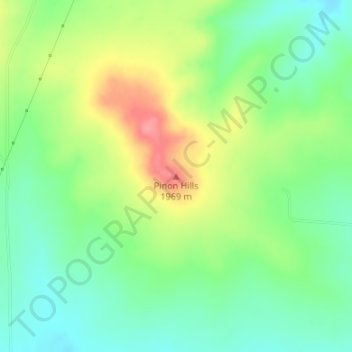
Name: Pinon Hills topographic map, elevation, terrain.
Location: Pinon Hills, Colfax County, New Mexico, United States (36.27971 -104.72421 36.27981 -104.72411)
Average elevation: 1,920 m
Minimum elevation: 1,886 m
Maximum elevation: 1,974 m
Thank you for supporting this site ❤️
Make a donation
Make a donation
Other topographic maps
Click on a map to view its topography, its elevation and its terrain.