
Thank you for supporting this site ❤️
Make a donation
Make a donation
East Valley topographic map
Click on the map to display elevation.
Thank you for supporting this site ❤️
Make a donation
Make a donation
About this map
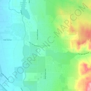
Name: East Valley topographic map, elevation, terrain.
Location: East Valley, Douglas County, Nevada, 89410, United States (38.91703 -119.71583 38.95703 -119.67583)
Average elevation: 1,510 m
Minimum elevation: 1,463 m
Maximum elevation: 1,623 m
Thank you for supporting this site ❤️
Make a donation
Make a donation
Other topographic maps
Click on a map to view its topography, its elevation and its terrain.