
Melling topographic map
Interactive map
Click on the map to display elevation.
About this map
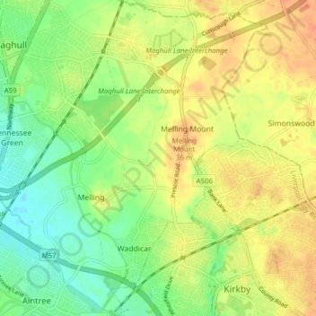
Name: Melling topographic map, elevation, terrain.
Average elevation: 26 m
Minimum elevation: 7 m
Maximum elevation: 42 m
Other topographic maps
Click on a map to view its topography, its elevation and its terrain.
Maghull
United Kingdom > England > Sefton
Maghull, Sefton, Liverpool City Region, England, United Kingdom
Average elevation: 18 m
Southport
United Kingdom > England > Sefton
Southport, Sefton, Liverpool City Region, England, PR8 1AH, United Kingdom
Average elevation: 4 m