
Styx topographic map
Interactive map
Click on the map to display elevation.
About this map
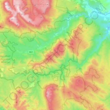
Name: Styx topographic map, elevation, terrain.
Location: Styx, Derwent Valley, Tasmania, Australia (-42.86051 146.48259 -42.68408 146.82939)
Average elevation: 595 m
Minimum elevation: 65 m
Maximum elevation: 1,419 m
Other topographic maps
Click on a map to view its topography, its elevation and its terrain.
Cradle Mountain
Cradle Mountain, Meander Valley, Tasmania, Australia
Average elevation: 1,144 m
Scottsdale
Australia > Tasmania > Scottsdale
Scottsdale, Dorset, Tasmania, 7620, Australia
Average elevation: 179 m
Franklin-Gordon Wild Rivers National Park
Australia > Tasmania > Strathgordon
Franklin-Gordon Wild Rivers National Park, Olga Street, Strathgordon, Tasmania, Australia
Average elevation: 440 m