
Ablanéu topographic map
Interactive map
Click on the map to display elevation.
About this map
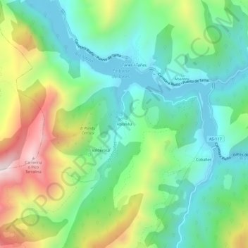
Name: Ablanéu topographic map, elevation, terrain.
Location: Ablanéu, Caso, Asturië, Spanje (43.17605 -5.42275 43.21605 -5.38275)
Average elevation: 749 m
Minimum elevation: 482 m
Maximum elevation: 1,305 m
Other topographic maps
Click on a map to view its topography, its elevation and its terrain.