
迤车镇 topographic map
Interactive map
Click on the map to display elevation.
About this map
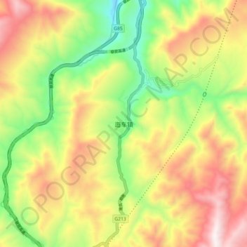
Name: 迤车镇 topographic map, elevation, terrain.
Location: 迤车镇, 会泽县, 曲靖市, 云南省, 中国 (26.90650 103.54328 26.98650 103.62328)
Average elevation: 1,867 m
Minimum elevation: 1,312 m
Maximum elevation: 2,482 m
Other topographic maps
Click on a map to view its topography, its elevation and its terrain.