
Thank you for supporting this site ❤️
Make a donation
Make a donation
Skylight topographic map
Click on the map to display elevation.
Thank you for supporting this site ❤️
Make a donation
Make a donation
About this map
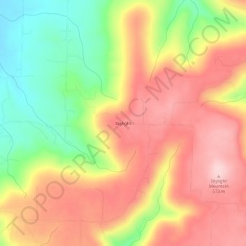
Name: Skylight topographic map, elevation, terrain.
Location: Skylight, Washington County, Arkansas, 72717, United States (35.82230 -94.41438 35.86230 -94.37438)
Average elevation: 476 m
Minimum elevation: 349 m
Maximum elevation: 577 m
Thank you for supporting this site ❤️
Make a donation
Make a donation
Other topographic maps
Click on a map to view its topography, its elevation and its terrain.