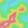
Avon topographic map
Click on the map to display elevation.
Avon
According to the United States Census Bureau, the town has a total area of 41.65 square miles (107.87 km2), of which 41.39 square miles (107.20 km2) is land and 0.26 square miles (0.67 km2) is water. Avon is drained by the Sandy River, a tributary of the Kennebec River. Mount Blue, elevation 3,192 feet (973 meters) above sea level (and part of Mount Blue State Park), is located in the southwestern corner of Avon.
About this map

Name: Avon topographic map, elevation, terrain.
Location: Avon, Franklin County, Maine, United States (44.71798 -70.39647 44.84647 -70.23686)
Average elevation: 293 m
Minimum elevation: 108 m
Maximum elevation: 958 m
Other topographic maps
Click on a map to view its topography, its elevation and its terrain.

Tumbledown Mountain
United States > Maine > Franklin County > Township 6 North of Weld
Average elevation: 711 m

Height of Land
United States > Maine > Franklin County > Township D > Rangeley Plantation
Average elevation: 584 m
Height of Land
United States > Maine > Franklin County > Township D > Rangeley Plantation
Average elevation: 584 m