
Thank you for supporting this site ❤️
Make a donation
Make a donation
Chemin de la Tuilerie topographic map
Click on the map to display elevation.
Thank you for supporting this site ❤️
Make a donation
Make a donation
About this map
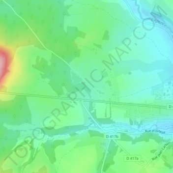
Name: Chemin de la Tuilerie topographic map, elevation, terrain.
Average elevation: 308 m
Minimum elevation: 263 m
Maximum elevation: 426 m
Thank you for supporting this site ❤️
Make a donation
Make a donation
Other topographic maps
Click on a map to view its topography, its elevation and its terrain.
Villars-Saint-Marcellin
France > Grand Est > Haute-Marne > Bourbonne-les-Bains
Average elevation: 297 m