
Make a donation
Scarborough topographic map
Click on the map to display elevation.
Make a donation
Scarborough
Topographically, the district is dominated by two watersheds, Highland Creek and the Rouge River. Highland Creek lies almost entirely within Scarborough and occupies approximately 70% of its total area. It occupies the western half of Scarborough, while the Rouge River flows through the eastern portion. Both of these rivers flow into Lake Ontario. Due to the location of the Lakeshore CN railway right-of-way, both river deltas are constricted to narrow channels where they flow into the lake.
Make a donation
About this map
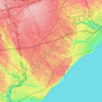
Name: Scarborough topographic map, elevation, terrain.
Location: Scarborough, Toronto, Golden Horseshoe, Ontario, Canada (43.66972 -79.34134 43.85544 -79.11322)
Average elevation: 138 m
Minimum elevation: 71 m
Maximum elevation: 209 m
Make a donation
Other topographic maps
Click on a map to view its topography, its elevation and its terrain.