
Calicanto topographic map
Interactive map
Click on the map to display elevation.
About this map
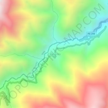
Name: Calicanto topographic map, elevation, terrain.
Location: Calicanto, Ayna, La Mar, Ayacucho, Peru (-12.75984 -73.98986 -12.71984 -73.94986)
Average elevation: 2,450 m
Minimum elevation: 1,732 m
Maximum elevation: 3,349 m
Other topographic maps
Click on a map to view its topography, its elevation and its terrain.