
Thank you for supporting this site ❤️
Make a donation
Make a donation
Rohinibera topographic map
Click on the map to display elevation.
Thank you for supporting this site ❤️
Make a donation
Make a donation
About this map
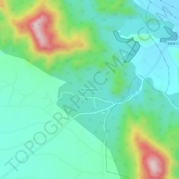
Name: Rohinibera topographic map, elevation, terrain.
Location: Rohinibera, Potka, East Singhbhum, Jharkhand, 832102, India (22.62396 86.30064 22.66396 86.34064)
Average elevation: 206 m
Minimum elevation: 107 m
Maximum elevation: 493 m
Thank you for supporting this site ❤️
Make a donation
Make a donation