
Thank you for supporting this site ❤️
Make a donation
Make a donation
Gum Springs topographic map
Click on the map to display elevation.
Thank you for supporting this site ❤️
Make a donation
Make a donation
About this map
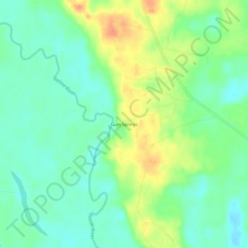
Name: Gum Springs topographic map, elevation, terrain.
Location: Gum Springs, Cleveland County, Arkansas, United States (33.95871 -92.29404 33.99871 -92.25404)
Average elevation: 54 m
Minimum elevation: 38 m
Maximum elevation: 80 m
Thank you for supporting this site ❤️
Make a donation
Make a donation
Other topographic maps
Click on a map to view its topography, its elevation and its terrain.