
Thank you for supporting this site ❤️
Make a donation
Make a donation
Kirchzarten (Kernort) topographic map
Click on the map to display elevation.
Thank you for supporting this site ❤️
Make a donation
Make a donation
Kirchzarten (Kernort)
Bedeutsam ist vor allem der Tourismus wegen der Nähe zu Freiburg und zu den Höhen des Schwarzwaldes. Es gibt einen Campingplatz und das Kurhaus bietet Tagungsmöglichkeiten.
Thank you for supporting this site ❤️
Make a donation
Make a donation
About this map
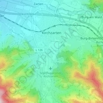
Name: Kirchzarten (Kernort) topographic map, elevation, terrain.
Average elevation: 464 m
Minimum elevation: 345 m
Maximum elevation: 863 m
Thank you for supporting this site ❤️
Make a donation
Make a donation