
Thank you for supporting this site ❤️
Make a donation
Make a donation
Urke topographic map
Click on the map to display elevation.
Thank you for supporting this site ❤️
Make a donation
Make a donation
About this map
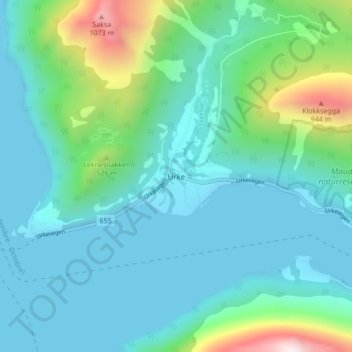
Name: Urke topographic map, elevation, terrain.
Location: Urke, Ørsta, Møre og Romsdal, 6196, Norvège (62.19270 6.54867 62.23270 6.58867)
Average elevation: 226 m
Minimum elevation: -11 m
Maximum elevation: 1,228 m
Thank you for supporting this site ❤️
Make a donation
Make a donation
Other topographic maps
Click on a map to view its topography, its elevation and its terrain.