
Thank you for supporting this site ❤️
Make a donation
Make a donation
Porjus topographic map
Click on the map to display elevation.
Thank you for supporting this site ❤️
Make a donation
Make a donation
About this map
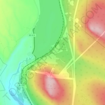
Name: Porjus topographic map, elevation, terrain.
Location: Porjus, Jokkmokks kommun, Norrbotten County, Sweden (66.94008 19.80223 66.98008 19.84223)
Average elevation: 410 m
Minimum elevation: 310 m
Maximum elevation: 543 m
Thank you for supporting this site ❤️
Make a donation
Make a donation
Other topographic maps
Click on a map to view its topography, its elevation and its terrain.