
Make a donation
Izra topographic map
Click on the map to display elevation.
Make a donation
Izra
Izraa or Izra (Arabic: إِزْرَع, romanized: Izraʿ) is a city in the Daraa Governorate of Syria, to the north of the city of Daraa. It is the administrative centre of the Izraa District, and sits at an altitude of 599 metres. According to the Syria Central Bureau of Statistics (CBS), Izraa had a population of 19,158 in the 2004 census. It is the administrative center of a nahiyah ("subdistrict") consisting of 21 localities with a combined population of 56,760 in the 2004 census. Its inhabitants are predominantly Sunni Muslims, while Christians constitute a large minority.
Make a donation
About this map
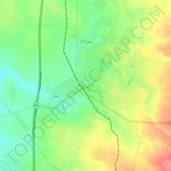
Name: Izra topographic map, elevation, terrain.
Average elevation: 583 m
Minimum elevation: 553 m
Maximum elevation: 626 m
Make a donation
Other topographic maps
Click on a map to view its topography, its elevation and its terrain.