
Thank you for supporting this site ❤️
Make a donation
Make a donation
Phiring topographic map
Click on the map to display elevation.
Thank you for supporting this site ❤️
Make a donation
Make a donation
About this map
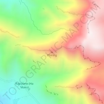
Name: Phiring topographic map, elevation, terrain.
Location: Phiring, Mohale's Hoek District, Lesotho (-30.05022 27.58747 -30.05012 27.58757)
Average elevation: 2,147 m
Minimum elevation: 1,712 m
Maximum elevation: 2,596 m
Thank you for supporting this site ❤️
Make a donation
Make a donation