
Thank you for supporting this site ❤️
Make a donation
Make a donation
Edgemont topographic map
Click on the map to display elevation.
Thank you for supporting this site ❤️
Make a donation
Make a donation
About this map
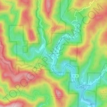
Name: Edgemont topographic map, elevation, terrain.
Location: Edgemont, Caldwell County, North Carolina, United States (35.98235 -81.79483 36.02235 -81.75483)
Average elevation: 588 m
Minimum elevation: 450 m
Maximum elevation: 751 m
Thank you for supporting this site ❤️
Make a donation
Make a donation
Other topographic maps
Click on a map to view its topography, its elevation and its terrain.