
Thank you for supporting this site ❤️
Make a donation
Make a donation
Hazlemere topographic map
Click on the map to display elevation.
Thank you for supporting this site ❤️
Make a donation
Make a donation
About this map
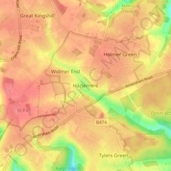
Name: Hazlemere topographic map, elevation, terrain.
Location: Hazlemere, Buckinghamshire, England, HP15 7EP, United Kingdom (51.63805 -0.72894 51.67805 -0.68894)
Average elevation: 166 m
Minimum elevation: 114 m
Maximum elevation: 192 m
Thank you for supporting this site ❤️
Make a donation
Make a donation
Other topographic maps
Click on a map to view its topography, its elevation and its terrain.