
Los Altos topographic map
Interactive map
Click on the map to display elevation.
About this map
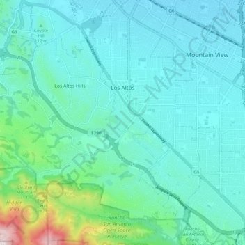
Name: Los Altos topographic map, elevation, terrain.
Average elevation: 116 m
Minimum elevation: 10 m
Maximum elevation: 698 m
Other topographic maps
Click on a map to view its topography, its elevation and its terrain.
Los Altos Hills
Vereinigte Staaten von Amerika > Kalifornien > Santa Clara County
Los Altos Hills, Santa Clara County, Kalifornien, Vereinigte Staaten von Amerika
Average elevation: 146 m