
Thank you for supporting this site ❤️
Make a donation
Make a donation
Schmölln topographic map
Click on the map to display elevation.
Thank you for supporting this site ❤️
Make a donation
Make a donation
About this map
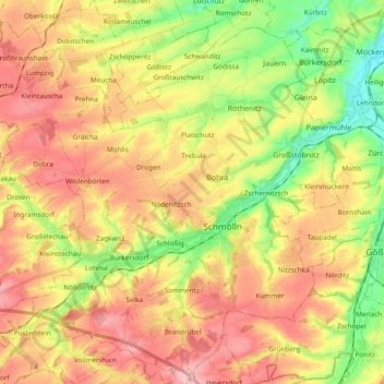
Name: Schmölln topographic map, elevation, terrain.
Location: Schmölln, Altenburger Land, Thüringen, 04626, Deutschland (50.84741 12.22361 50.96795 12.41060)
Average elevation: 254 m
Minimum elevation: 183 m
Maximum elevation: 317 m
Thank you for supporting this site ❤️
Make a donation
Make a donation
Other topographic maps
Click on a map to view its topography, its elevation and its terrain.
Steinsdorf
Deutschland > Thüringen > Altenburger Land > Schmölln > Burkersdorf
Average elevation: 255 m
Thank you for supporting this site ❤️
Make a donation
Make a donation
Thank you for supporting this site ❤️
Make a donation
Make a donation
Thank you for supporting this site ❤️
Make a donation
Make a donation