
Thank you for supporting this site ❤️
Make a donation
Make a donation
Sutton County topographic map
Click on the map to display elevation.
Thank you for supporting this site ❤️
Make a donation
Make a donation
About this map
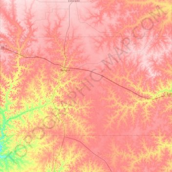
Name: Sutton County topographic map, elevation, terrain.
Location: Sutton County, Texas, 76950, United States (30.28765 -100.96064 30.71046 -100.11602)
Average elevation: 687 m
Minimum elevation: 548 m
Maximum elevation: 761 m
Thank you for supporting this site ❤️
Make a donation
Make a donation
Other topographic maps
Click on a map to view its topography, its elevation and its terrain.