
Spring Valley topographic map
Interactive map
Click on the map to display elevation.
About this map
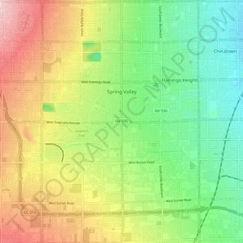
Name: Spring Valley topographic map, elevation, terrain.
Location: Spring Valley, Clark County, Nevada, États-Unis d'Amérique (36.05553 -115.31548 36.14453 -115.20787)
Average elevation: 736 m
Minimum elevation: 653 m
Maximum elevation: 853 m
Other topographic maps
Click on a map to view its topography, its elevation and its terrain.
North Las Vegas
États-Unis d'Amérique > Nevada > Clark County
North Las Vegas, Clark County, Nevada, États-Unis d'Amérique
Average elevation: 684 m
Las Vegas
États-Unis d'Amérique > Nevada > Clark County
Las Vegas, Clark County, Nevada, États-Unis d'Amérique
Average elevation: 756 m