
Make a donation
Bamian topographic map
Click on the map to display elevation.
Make a donation
Bamian
Bamyan (Pashto, Dari: بامیان), also spelled Bamian or Bamiyan, is the capital of Bamyan Province in central Afghanistan. Its population of approximately 100,000 people makes it the largest city in the Hazarajat region of Afghanistan. Bamyan is at an altitude of about 8,366 feet (2,550 m) above sea level. The Bamyan Airport is located in the middle of the city. The driving distance between Bamyan and Kabul in the southeast is approximately 180 kilometres (110 mi). The Band-e-Amir National Park is to the west, about a half-hour drive from the city of Bamyan.
Make a donation
About this map
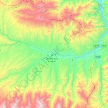
Name: Bamian topographic map, elevation, terrain.
Location: Bamian, Bamyan, Bamyan Province, Afghanistan (34.66238 67.67683 34.98238 67.99683)
Average elevation: 3,174 m
Minimum elevation: 2,219 m
Maximum elevation: 4,749 m
Make a donation