
Thank you for supporting this site ❤️
Make a donation
Make a donation
Temangan topographic map
Click on the map to display elevation.
Thank you for supporting this site ❤️
Make a donation
Make a donation
About this map
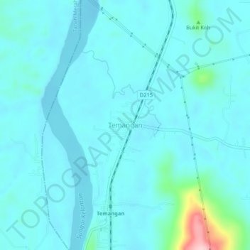
Name: Temangan topographic map, elevation, terrain.
Location: Temangan, Machang, Kelantan, Malaysia (5.69563 102.13430 5.73563 102.17430)
Average elevation: 31 m
Minimum elevation: 8 m
Maximum elevation: 211 m
Thank you for supporting this site ❤️
Make a donation
Make a donation
Other topographic maps
Click on a map to view its topography, its elevation and its terrain.
Kelantan River
Malaysia > Kelantan > Kampung Paloh
The river's tributaries rise in the forested mountains in the Gua Musang region in southern Kelantan, where many Orang Asli tribes live. The area is known for its karst topography, dotted with mogotes with numerous caves beneath them. Some cave systems along the Nenggiri River, the river's left tributary, show…
Average elevation: 71 m