
Holz topographic map
Interactive map
Click on the map to display elevation.
About this map
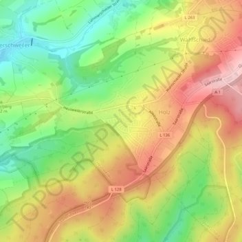
Name: Holz topographic map, elevation, terrain.
Average elevation: 336 m
Minimum elevation: 237 m
Maximum elevation: 437 m
Other topographic maps
Click on a map to view its topography, its elevation and its terrain.
Nagelsberg
Deutschland > Saarland > Regionalverband Saarbrücken > Heusweiler
Nagelsberg, Heusweiler, Regionalverband Saarbrücken, Saarland, 66346, Deutschland
Average elevation: 252 m
Eiweiler
Deutschland > Saarland > Regionalverband Saarbrücken > Heusweiler
Eiweiler, Heusweiler, Regionalverband Saarbrücken, Saarland, Deutschland
Average elevation: 284 m
Kutzhof
Deutschland > Saarland > Regionalverband Saarbrücken > Heusweiler
Kutzhof, Heusweiler, Regionalverband Saarbrücken, Saarland, Deutschland
Average elevation: 310 m