
Thank you for supporting this site ❤️
Make a donation
Make a donation
Irschenberg topographic map
Click on the map to display elevation.
Thank you for supporting this site ❤️
Make a donation
Make a donation
About this map
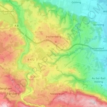
Name: Irschenberg topographic map, elevation, terrain.
Location: Irschenberg, Landkreis Miesbach, Бавария, 83737, Германия (47.77353 11.83076 47.86489 11.95884)
Average elevation: 642 m
Minimum elevation: 477 m
Maximum elevation: 883 m
Thank you for supporting this site ❤️
Make a donation
Make a donation
Other topographic maps
Click on a map to view its topography, its elevation and its terrain.