
José topographic map
Interactive map
Click on the map to display elevation.
About this map
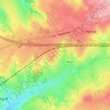
Name: José topographic map, elevation, terrain.
Location: José, Herve, Verviers, Liège, Wallonie, 4650, Belgique (50.61055 5.75249 50.65055 5.79249)
Average elevation: 262 m
Minimum elevation: 192 m
Maximum elevation: 320 m
Other topographic maps
Click on a map to view its topography, its elevation and its terrain.
Xhendelesse
Belgique > Liège > Verviers > Herve
Xhendelesse, Herve, Verviers, Liège, Wallonie, 4650, Belgique
Average elevation: 242 m