
Tiefgraben topographic map
Interactive map
Click on the map to display elevation.
About this map
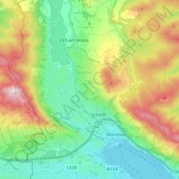
Name: Tiefgraben topographic map, elevation, terrain.
Location: Tiefgraben, Bezirk Vöcklabruck, Haute-Autriche, 5310, Autriche (47.84297 13.27012 47.91325 13.40170)
Average elevation: 693 m
Minimum elevation: 474 m
Maximum elevation: 1,112 m