
Thank you for supporting this site ❤️
Make a donation
Make a donation
Riverview topographic map
Click on the map to display elevation.
Thank you for supporting this site ❤️
Make a donation
Make a donation
About this map
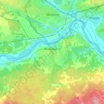
Name: Riverview topographic map, elevation, terrain.
Location: Riverview, Albert County, New Brunswick, Canada (46.02391 -64.89074 46.09187 -64.73009)
Average elevation: 41 m
Minimum elevation: -1 m
Maximum elevation: 128 m
Thank you for supporting this site ❤️
Make a donation
Make a donation
Other topographic maps
Click on a map to view its topography, its elevation and its terrain.