
Ferriere topographic map
Interactive map
Click on the map to display elevation.
About this map
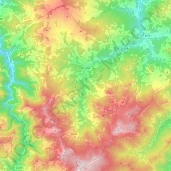
Name: Ferriere topographic map, elevation, terrain.
Location: Ferriere, Piacenza, Emilia-Romagna, 29024, Italy (44.55588 9.38697 44.70072 9.60321)
Average elevation: 986 m
Minimum elevation: 372 m
Maximum elevation: 1,766 m