
Eltendorf topographic map
Interactive map
Click on the map to display elevation.
About this map
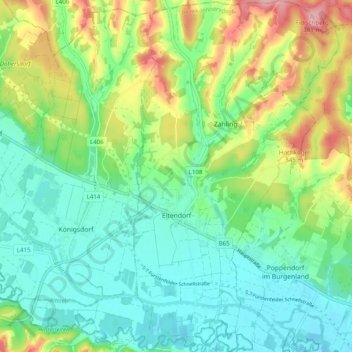
Name: Eltendorf topographic map, elevation, terrain.
Location: Eltendorf, Jennersdorf, Burgenland, 7562, Österreich (46.98123 16.18700 47.04845 16.24457)
Average elevation: 267 m
Minimum elevation: 220 m
Maximum elevation: 369 m