
Ulrichsbichl topographic map
Interactive map
Click on the map to display elevation.
About this map
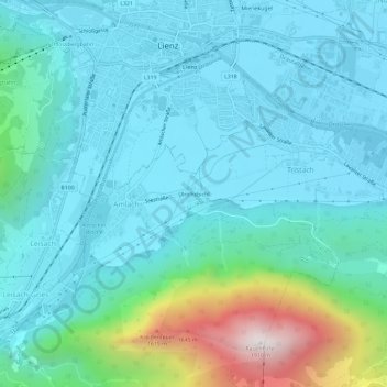
Name: Ulrichsbichl topographic map, elevation, terrain.
Location: Ulrichsbichl, Amlach, Bezirk Lienz, 9908, Österreich (46.79455 12.75203 46.83455 12.79203)
Average elevation: 873 m
Minimum elevation: 655 m
Maximum elevation: 1,894 m